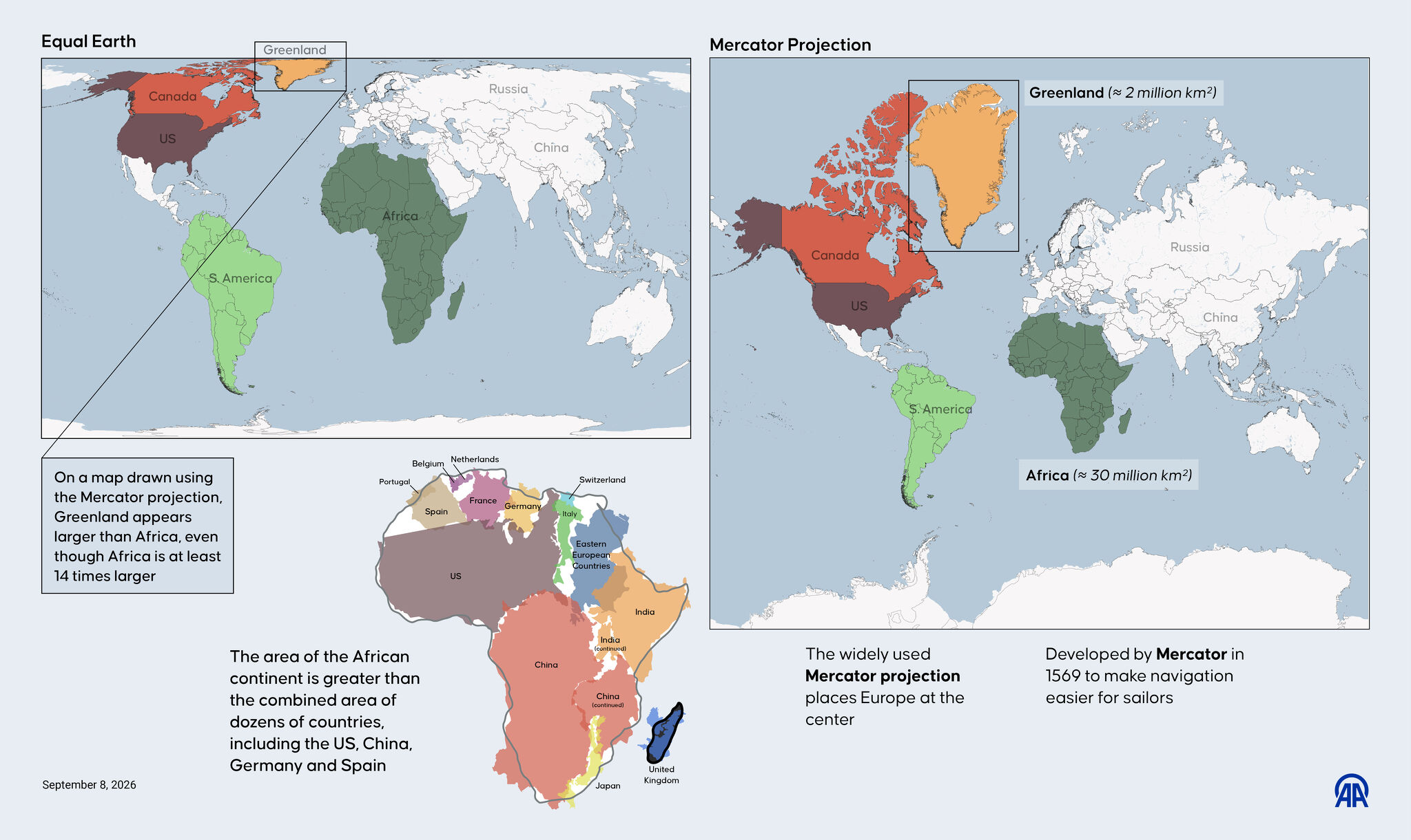

New Equal Earth map shrinks Greenland. What happens to Texas?
- Posted on September 15, 2026
- By The Dallas Morning News
- 1 Views
- 1 min read
The United Nations General Assembly has officially endorsed the Equal Earth projection, marking a significant shift in cartographic standards. This decision aims to eliminate the distortions inherent in the Mercator projection, which has dominated world maps for centuries. The Equal Earth model provides accurate representations of landmass sizes, revealing how traditional maps have systematically misrepresented countries, particularly affecting perceptions of Greenland and other northern regions. This geographical revolution promises to reshape how we visualize and understand our planet's true proportions.
Summary auto-generated by AI from the original publisher's content. Editorial standards.